
Innovation · Smart Cities
The
Smart City
solution for Chile
Visionaria integrates surveillance, traffic management, access control and response drones into a unified ecosystem designed for Chilean cities. Real-time data, centralized coordination and faster response to every incident.

SANTIAGO, CHILE · SMART CITY PLATFORM
What are the challenges of building a smart city?
A smart city is an environment where digital solutions optimize the use of infrastructure and services, improving residents' quality of life. However, the road to that goal comes with concrete challenges:
- Isolated legacy systems that don't talk to each other
- Insufficient network infrastructure for real-time data
- Scaling existing solutions is costly and inefficient
- Lack of unified visibility for decision-making
- Fragmented coordination between security agencies
Visionaria's answer
An integrated ecosystem connecting cameras, sensors, drones, access control and communications in a single management platform.
We work with the world's best brands — Genetec, DJI, Axis, Hikvision — and integrate every component so operators see everything on one screen and respond in seconds, not minutes.
< 90s
DFR response time
24/7
Continuous monitoring
80 km
Network range
Capabilities
Smart Cities ecosystem modules
Each module operates standalone or fully integrated with the rest
Public Safety
IoT sensors integrated with our platform enable real-time monitoring, data collection and automated emergency responses. We significantly improve urban resilience, with an emphasis on incident prevention and police coordination.
Automatic detection of incidents and anomalous behavior
Integration with Carabineros and police dispatch systems
Real-time alerts to unified command centers
24/7 coverage with power backup and network redundancy
Smart Surveillance
High-resolution IP camera network with AI-based video analytics. Detects events in real time without constant human intervention, optimizing each municipality's operational resources.
Long-range PTZ cameras with 40x optical zoom
Analytics: people counting, loitering detection, abandoned objects
License plate recognition (LPR) at gantries and entry points
Centralized management from a Genetec control room
Traffic Management
Integrated solutions for real-time monitoring and management of vehicle flow. We reduce congestion, improve emergency response times and deliver valuable data for urban planning.
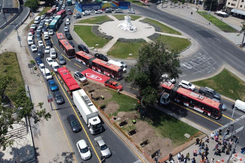
Vehicle counting and average-speed analysis
Violation detection: red light, wrong-way driving, speeding
Integration with smart traffic lights and variable message signs
Real-time traffic dashboard for authorities
Access Control
Vehicle and pedestrian access control platforms for critical areas, municipal buildings and sensitive perimeters. Fully integrated with the video surveillance ecosystem for complete perimeter security.
Vehicle barriers with automatic plate recognition
Biometric control (facial, fingerprint) at critical facilities
Whitelists and blacklists synced in real time
Complete audit trail with associated video evidence
Environmental Monitoring
Environmental monitoring is essential for urban management, improving public health, safety and sustainability. IoT sensors distributed across the city collect and analyze environmental data in real time, enabling informed decisions by municipal authorities.
Distance sensors in containers: fill-level monitoring and waste-collection route optimization
Solenoid valve controllers: automated irrigation based on time, flow and soil moisture
Detection cameras: monitoring of green spaces, pest infestations and signs of vandalism
Soil moisture sensors: real-time data on soil humidity, temperature and electrical conductivity
Weather stations: temperature, humidity, wind speed/direction, barometric pressure and rainfall
Drone as First Responder (DFR)
Autonomous drone system deployed from fixed stations that responds to alarms in under 90 seconds. The Drone Tactical Command Center coordinates automatic dispatch and streams live video to the command center.
Arrival time at the alarm location: under 90 seconds
Full HD live video streamed to the control room
Integration with PTZ cameras for coordinated tracking
24/7 operation with automatic recharging at the DJI Dock station
Results
What benefits will you get?
Data-driven decision making
IoT sensors analyze large data flows and quickly identify patterns. This leads to actionable insights for urban planning, resource allocation and overall city management.
Efficient public services and infrastructure
Real-time data integration optimizes the operation of critical services: smart lighting, waste management, traffic and emergencies — reducing costs and improving service quality.
Greater civic engagement and experience
A safer, cleaner and more efficient city directly improves residents' quality of life and builds trust in public institutions through measurable, transparent results.
Is your municipality ready for the next level?
Let's talk about your city's specific needs. Our team designs a tailored solution.